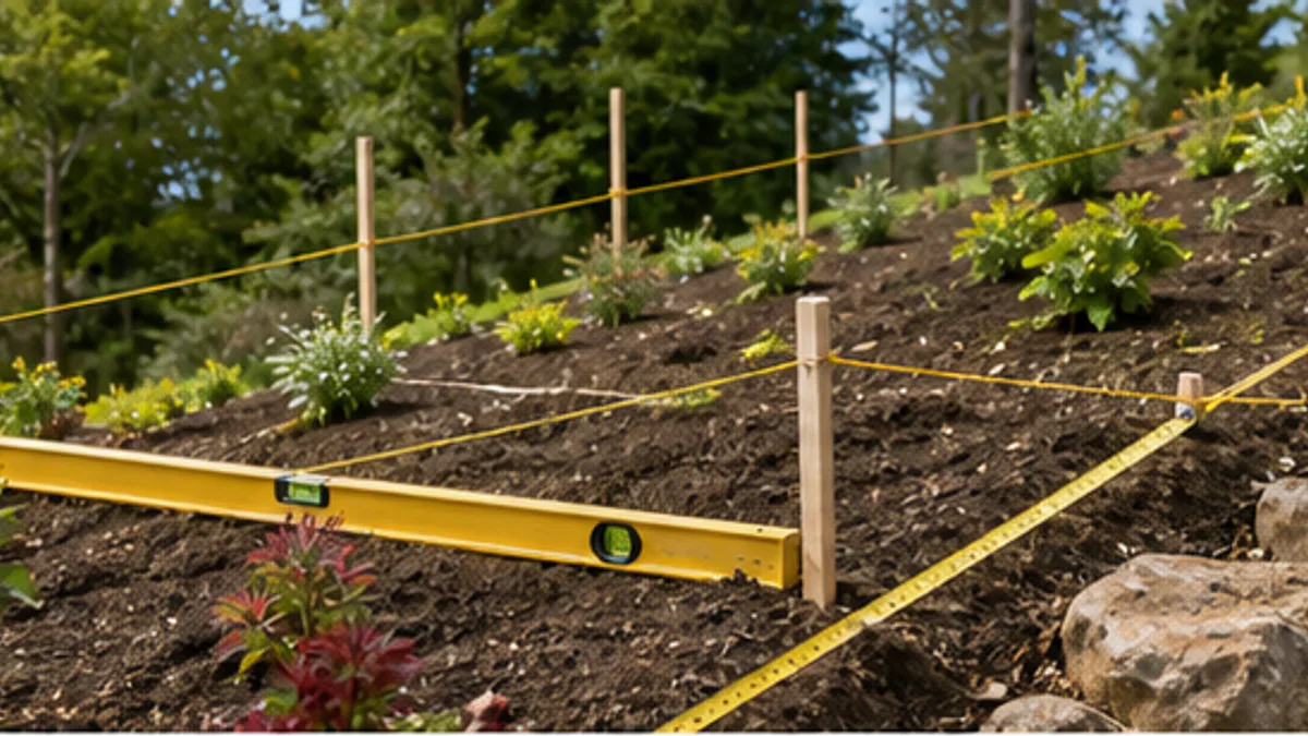
A tape laid on a hillside gives the length of the ground surface. A level line gives horizontal run, and the gap below it gives rise or fill depth. All three can be valid measurements, but they answer different questions.
First sketch the bed from above. Then identify whether the new material will follow the existing slope or create a different finished plane. That decision determines which area and depth belong in the volume calculation.
How do you measure a garden bed on a slope?
For a uniform mulch or compost layer that follows the hill, use the true sloped surface area and one layer depth. For soil that fills toward a level or newly graded surface, divide the horizontal footprint into zones and measure the vertical fill depth in each zone. Do not multiply the sloped surface area by the deepest fill reading. That combines two different measurements and overstates most tapered fills.
Calculate each measured fill zoneChoose between a surface layer and a fill volume
The intended finished surface tells you whether slope changes area, depth, or both.
Mulch spread at a constant two-inch thickness normally stays parallel to the existing ground. Its coverage follows the hillside, so the tape measurement along the slope is relevant. The layer depth should be measured perpendicular to that surface, just as it would be on flat ground.
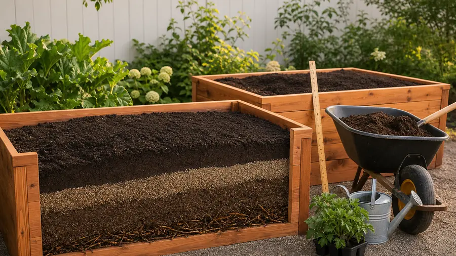
Soil added to make a level planting platform is different. Its top follows a target line while the existing ground falls away below it. Fill depth therefore changes from the high side to the low side. The calculation needs horizontal plan area and several vertical depth readings.
A third project may preserve a designed slope but change its grade. Treat the existing and proposed surfaces as separate elevation maps. Small residential estimates can use measured zones; major cut-and-fill work needs a grading plan rather than a single garden calculator entry.
Measure rise and horizontal run with a level reference
Place one stake uphill and one downhill, level a string between them, and measure the vertical gap at the downhill stake.
The level string represents horizontal run. The vertical difference between the string and equal reference points on the stakes is rise. University of Wisconsin–Madison's rain-garden field sheet uses this stake, level string, rise, and run method. Repeat it wherever the grade visibly changes instead of assuming one reading represents the whole bed.
Slope percent equals rise divided by horizontal run, multiplied by 100. A one-foot rise over a 12-foot horizontal run is 8.33 percent. Iowa State University Extension and the USDA Natural Resources Conservation Service use rise over run for percent slope.
Percent is not the same as degrees. A 100-percent slope has equal rise and run and is 45 degrees, as the NRCS explains. Record the form shown by your instrument; silently treating 10 degrees as 10 percent changes the geometry.
Use surface length only when the layer follows the ground
For one straight slope, calculate surface length from horizontal run and rise, then multiply by bed width.
The run, rise, and surface length form a right triangle. Surface length equals the square root of run squared plus rise squared. If a bed runs 12 horizontal feet, rises 1 foot, and is 6 feet wide, its straight slope length is √(12² + 1²), or 12.04 feet.
The sloped surface area is therefore 12.04 × 6 = 72.25 square feet. A two-inch layer parallel to that surface needs 72.25 × 2 ÷ 12 = 12.04 cubic feet, or 0.45 cubic yard before any project-specific purchasing adjustment.
This simple triangle applies only where the ground behaves like one plane and the width is measured across it. A convex bank, concave swale, terraces, or several changing grades should be split into smaller sections. For curved or irregular boundaries, first use the irregular garden-bed measurement method, then apply the slope measurement within each section.
A level fill uses horizontal area and changing vertical depth
Set the intended finished plane, measure vertically down to existing soil, and keep that depth attached to its location.
Use stakes, a verified level string, or a laser reference to mark the target surface. Do not use a sagging string or measure diagonally along the hillside. At each point, measure the vertical gap from target to firm existing soil and note whether it needs fill, no change, or removal.
For a simple straight wedge that changes evenly from zero to 12 inches, the average vertical depth is 6 inches. With a horizontal plan area of 12 × 6 = 72 square feet, volume is 72 × 6 ÷ 12 = 36 cubic feet, or 1.33 cubic yards.
Linear wedge volume = horizontal plan area × (high-side depth + low-side depth) ÷ 2.
Notice that this is not the 72.25-square-foot sloped surface multiplied by 12 inches. That incorrect combination gives about 72.25 cubic feet—roughly double the actual simple wedge—because it applies the maximum depth to the entire surface.
Use a grid when the slope or target depth is uneven
Divide the horizontal footprint into equal cells, record vertical depth at repeatable points, calculate each cell, and add the results.
- Draw the plan boundary. Mark the high side, low side, fixed edging, trees, drains, utilities, structures, and no-fill areas.
- Choose a cell size. Use smaller cells where the ground bends, drops, or contains a depression; larger uniform areas can use wider spacing.
- Set one target datum. Keep every vertical reading tied to the same verified finished plane or documented grade.
- Record depth by location. Average the corner readings for a cell, or use a center reading only when it reasonably represents that cell.
- Calculate and sum. Multiply each cell's horizontal area by its average vertical depth in feet. Keep cut cells and fill cells on separate lines.
Make the grid denser until adding measurement points no longer changes the planning total materially. A single average of the highest and lowest readings is reliable only for a genuinely straight, evenly changing plane. It can miss a hollow, mound, terrace, or diagonal fall.
Keep the measurement worksheet auditable
Record the datum, measurement direction, units, zones, and exclusions beside the number that enters the calculator.
| Project | Area to measure | Depth to measure | Best calculation |
|---|---|---|---|
| Uniform layer following slope | True sloped surface | Constant layer, perpendicular to surface | Sloped area × layer depth |
| Simple linear fill wedge | Horizontal plan area | Vertical end depths | Plan area × average end depth |
| Uneven fill to target | Horizontal grid cells | Vertical depth by cell | Sum of cell volumes |
| Major grading or retaining work | Surveyed existing and design surfaces | Professional cut-and-fill model | Qualified local design |
Write whether the quantity is loose delivery volume or intended installed volume. Settlement, compaction, spillage, inaccessible corners, and supplier increments are purchasing decisions, not reasons to distort the measured geometry. Add any allowance as a named line after the raw calculation.
Before ordering, repeat several readings from the opposite side of the bed and check the arithmetic independently. Photograph the stakes and labelled grid while the datum is still in place. If a second measurement changes the total, resolve the source—string level, units, boundary, or depth—rather than averaging two unexplained answers.
Enter each uniform area and depth in the Topsoil Calculator. If one broad zone still contains sharply different depths, return to the worksheet and split it instead of forcing one convenient average.
Check drainage and stability before adding weight
A correct volume does not prove that the proposed grade, drainage, edge, or retaining structure is safe.
Iowa State Extension notes that sloped gardens are more vulnerable to erosion and can be harder to irrigate and access. Oklahoma State University Extension explains that runoff velocity increases as slope increases and that drainage problems can involve grading, soil, vegetation, mulch, and water arriving from upslope.
Do not bury a tree's root flare, block a drain, raise soil against siding, redirect runoff toward a building or neighbor, or cover an unexplained seep or erosion channel. Observe the site during rain and preserve the notes with the measurement sketch.
Colorado State University Extension says retaining walls and dry walls have specific design criteria and advises contacting the local building department for applicable code requirements. Significant grading, unstable soil, active erosion, drainage near structures, or a retaining edge is a boundary for qualified local help—not a larger buffer in a soil calculator.
If the project is actually a lawn correction, new-lawn root-zone build, or garden fill, use the lawn-leveling versus garden-fill guide to classify the application before selecting material and depth.
Sloped garden-bed measurement questions
Should I measure along the slope or horizontally?
Measure along the surface for a constant layer that follows the ground. Use horizontal plan area and vertical depths when fill meets a level or separately designed target surface.
Can I use the deepest point as the whole bed depth?
No, unless the entire bed truly has that depth. A simple linear taper can use its two end depths; an uneven bed should be divided into measured grid cells.
Is average depth always the high and low depth divided by two?
Only for an evenly changing straight plane. Hollows, mounds, terraces, and diagonal falls need more measurement points and separate zones.
Does this method design a retaining wall?
No. It estimates material geometry for a defined garden project. Retaining structures, major grading, and drainage may require permits and qualified local design.
Sources and measurement boundary
- Iowa State University Extension: Gardening on Slopes and Hillsides, for rise-over-run measurement and slope gardening risks.
- University of Wisconsin–Madison Arboretum: Measuring Slope for Rain Gardens, for the stake, level string, rise, and run field method.
- USDA Natural Resources Conservation Service: Slope Products, for percent-slope and degree definitions.
- Oklahoma State University Extension: Addressing Drainage Issues in the Urban Landscape, for slope, runoff, erosion, and grading context.
- Colorado State University Extension: Water-Wise Landscape Design Steps, for grading, erosion cover, and retaining-wall boundaries.
- NIST Guide to the SI, Appendix B, for length and volume conversion factors.
Change log: Published July 28, 2026 with a two-job slope diagram, variable-depth grid workflow, and checked surface-layer and wedge examples.
Last updated 11 November 2026